Mapping Gaza
How mapping specialists help keep staff safe

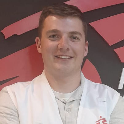
“An MSF logistician and a doctor are walking down a street. Or at least the remains of one: the street has been bombed beyond recognition at some point during the past 27 months.
They’re trying to scout a place to set up a new Médecins Sans Frontières / Doctors Without Borders (MSF) clinic, to provide healthcare to people in this particularly hard-to-access area in the north of the Gaza Strip.
The phones in their pockets vibrate simultaneously.
“You are getting close to the red zone. Take care my friend,” reads the message.
That’s from me. I’m part of MSF’s Geographical Information Systems (GIS) team and it’s my job to help keep our staff and operations safe. I work remotely and support teams on the ground with accurate, up-to-date maps and geographical information.
For those two team members, stepping into the no-go zone imposed by Israeli forces could have deadly consequences.
The GIS team at MSF has been going for over 10 years. We started small and now we’re a team of 50 people based all around the world. So it’s growing and it's getting more specialised. We’re being used more and more frequently during emergencies when geographically, the context is changing a lot. For example, if there's been a flood, or an earthquake or there's been war. This is when our role can provide unique value.
Up until now, I had never supported any MSF project where there's no ‘safe zone’. In Gaza, there are many no-go zones but there’s just no safe zone. Over 70,000 people have been killed in Gaza by Israeli forces since 7 October 2023, including fifteen MSF staff members.
It’s such a small place – only 370km squared – where even the tiniest distance can make a huge difference in terms of security. The challenge is how to communicate clearly so our teams working in Gaza know exactly where they need to avoid.


The power of mapping
I always say, ‘a map can tell a thousand words’. Reports and briefings are fine, but if it's too long or complicated, people won't read it. If it’s visual and available to access even without an internet connection, then our teams can understand the context quickly and easily.
My role can change depending on where I’m working. For example, when I supported an MSF project delivering a vaccination campaign in Malawi, the objective was to identify where the needs were. A lot of the space in the remote area of over 3,500 square kilometres hadn’t been digitally mapped. We were looking at the schools, assessing gaps in vaccination coverage, and working out how difficult it would be to get there by road.
In Gaza, MSF provides a lot of water and sanitation to people, so assessing needs is also important. But about 80 percent of my work is about trying to keep people safe.
Unlike in Malawi, in Gaza everything has been mapped. But when the ‘yellow line’ moves so frequently, things become complicated.

The yellow line
Since the ceasefire agreement on 10 October 2025, the Gaza Strip is effectively divided by a dangerous, ever-expanding and ambiguous yellow line controlled by the Israeli military.
One side of the line is under Israeli military control – marking 58 percent of the Strip – pushing the entire population of Gaza into the remaining 42 percent of the territory. The line is not clearly marked for Palestinians and is gradually shifting to the west.
MSF teams have received several patients with violent injuries related to the yellow line; Palestinians have been regularly shot by the Israeli forces while collecting water or firewood, or approaching their own homes that are near the line.
“To know what things really look like, I need to work closely with our local staff. I couldn’t do my job without them.”
In fact, there are three lines. First, there’s the official one that Israeli authorities have published online.
Then there’s the line which is physically marked by yellow blocks that are dropped from the sky. This doesn’t completely match the official one. This is where we believe the line actually is and we can see it from satellite imagery and sometimes our teams on the ground are also able to validate it.
Finally, there’s the orange line, just before the yellow line. To cross this line we must coordinate the movement with the Israeli side to avoid risk. We would need to tell them the route and the time of our movement in advance and any vehicle would be tracked.
One of our facilities was only one kilometre away from the orange line – too close – so they had to move by 700 metres because it was too dangerous.
But these lines only tell you so much, because Israel is still bombing places inside the so-called safe zone.
The importance of local knowledge
I’m very aware that in my role, I've never actually been to the place where I’m mapping. I know Gaza from the sky, but to really know the context and what things really look like, I need to work closely with our local staff. I couldn’t do my job without them.
Early on, we needed to map all the streets, all the junctions, and all the road names, making sure this matched the names Palestinians actually use. When there's an air strike, our security teams might name the location, for example there's one junction that's called 'Fish Fresh'. But some people might not know where this is. Now the junction is named on a big map you can point to, which is so useful.
Sometimes I think it's just MSF’s international staff who need the map. But when local staff use it and give positive feedback, it’s especially satisfying.
I never say “no” to people: there's always a way to do something. I'm a very small cog in the machine, but the work our teams in Gaza are doing is incredible. We support one in five beds in the Gaza Strip. When I think about the work on the ground, it makes my work meaningful.”
MSF and the genocide in Gaza
Despite the ceasefire agreement which came into effect on 10 October 2025, Israeli forces continue to kill and injure Palestinians - including children - with drones, airstrikes and shootings.
An agreement does not undo the immense suffering experienced by so many. Two years of catastrophic violence have left deep scars. More than 70,000 people have lost their lives during this genocide, including 15 of our own MSF colleagues.